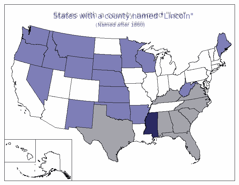
On the other hand, Patrick Ottenhoff at The Electoral map shows two maps of US states: one shows the states with a county named "Lincoln", and the other that shows states with a county named "Lee". Have a look at the two, then see this one, mashed up in a few seconds with Paint Shop Pro and 50% opaque layers.
There's no loss of clarity, and a considerable gain, in my humble opinion, in the ability to keep all the facts under observation without eye movement. (that's why Tufte called them *small* multiples, because large would mean too large a distance for the eye to travel)
By the way, there's also no reason for them to be jpegs. This PNG is 17K, compared to the originals which are over 100K. And yet the PNG loses no detail (ignore the superimposed text :-)